Surveying and Photogrammetry Laboratory

The Surveying and Photogrammetry Laboratory was established with the purpose of enabling students to practice surveying techniques using a wide spectrum of surveying equipment ranging from traditional levels, transits, and theodolites to the latest electronic total stations with data collectors and digital GPS equipment. Most of the field exercises undertaken by the students is carried out outside the laboratory room to gather field survey data, however, certain exercises can be conducted inside to accommodate adverse weather conditions.The surveying laboratory would help and enable students to understand the basic principles of surveying by conducting numerous field exercises using survey equipment.

The field exercises to be done are being discussed and explained to the students by the laboratory instructor inside the surveying laboratory room prior to the commencement of field survey. After field practices, reduction and calculation of field data for final result is being done in the laboratory room. Care and proper handling of surveying equipment is also emphasized before, during and after the survey. After practicing in the field, it may present research opportunities in many areas, such as gravimety, applied astronomy, teledetection, new equipment calibration, new techniques and others which students can learn.

The surveying laboratory would help and enable students to understand the basic principles of surveying by conducting numerous field exercises using survey equipment.

The laboratory is well equipped with modern instruments and accessories for practices, applications and demonstration of theories in surveying subjects associated with civil engineering courses, namely, surveying I, survey II, and survey camp. The surveying lab maintains a large list of equipment which includes Theodolite, Total Station, EDM Auto Level, Tilting Level, Laser Level, Digital Planimeter, Stereoscope, GPS, Survey equipment accessories: range poles, levelling staff, tripods, prisms (reflectors), tribrachs, etc.

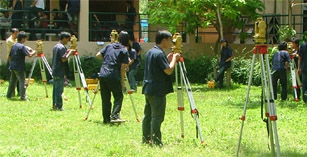
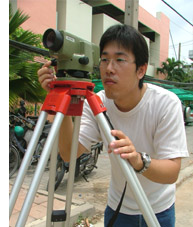
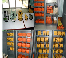
The lab covers the requirements of the laboratory portion of surveying courses. Experiments include:Distance by Pacing, Distance by Using Steel Tape, Setting a Temporary Benchmark Using Differential Leveling, Multi-Story Leveling, Profile and Cross-Section Leveling, Closing the Horizon, Double Angle Traverse, Angle Tape Traverse, Traverse Computations, Measurement by Triangulation, Indirect Measurement by Triangulation, Traverse Radiation, Topographic Survey, Laser Leveling and Topography, Boundary Survey, Sewer Layout with Offset Staking, Setting Slope Stakes, Vertical Curves, Horizontal Curve Layout, Setting Control Points, Site Platting and Subdivision, Plot Layout, Building Layout, and Road Layout.

Another experiment is GPS: Global Positioning System which includes plan and design GPS surveys, download, reduce, and store GPS data after field trips, analyze the GPS data, and compute the final coordinates of the GPS network.

Last, the photogrammetry area has several stereocompilers for the preparation of maps using aereal photographs and a great amount of smaller equipment to take measurements from aereal and terrestrial photos and for teledetection (to obtain information on the characteristics of an object without direct contact with it).

Scroll to Top